With our guides you will be able to personalize duration and difficulty of the routes based on your own wishes and walking pace. In a few clicks you can create your personalized hiking guides. Choose your starting point, your arrival point and, if you wish, even a middle point where to take a break.
The English Way is one of the most fascinating historic pilgrimage routes to Santiago de Compostela, an itinerary that retraces the medieval maritime routes used by pilgrims arriving from the British Isles and Northern Europe. This route develops from two possible starting points: Ferrol, with a path of about 118 kilometers that guarantees the achievement of the Compostela and A Coruña, with a shorter alternative of around 75 kilometers that does not reach the minimum distance required for the official certificate. Both variants cross the green landscapes of northern Galicia, offering pilgrims an intimate and authentic experience among ancient seaside villages, eucalyptus forests, medieval bridges and examples of Romanesque architecture. The route stands out for its quiet and reflective atmosphere, far from the crowds of the French Way, offering a more contemplative dimension of the pilgrimage through breathtaking coastal scenery, lush valleys and villages that have preserved their Galician soul intact.
Map of The Camino Ingles
Our guides
History and characteristics of the route
The English Way has its roots in the golden age of medieval pilgrimages, when devotees from England, Ireland, Scotland and the Scandinavian countries crossed the North Sea and the Bay of Biscay to reach the Galician coast. The decisive impulse behind this phenomenon came in 1122, when Pope Callixtus II granted Compostela the privilege of celebrating the Holy Years in perpetuity, during which pilgrims would obtain plenary indulgence—an irresistible attraction for the faithful eager to free themselves from the burden of their sins. The ports of Ferrol and A Coruña represented the natural gateways for these travelers who, after weeks at sea, finally set foot on Iberian soil to complete the final stretch on foot toward the tomb of the Apostle James. Pilgrimage had become a true medieval “all-inclusive”: merchant ships carried both goods and passengers and the entire organized journey, from departure from British ports to the return voyage, took approximately two or three weeks. The vessels remained anchored in Galician ports for seven or eight days, the time needed to load and unload merchandise, while pilgrims traveled on foot to Santiago, in hired wagon caravans, performing their devotions to the Apostle before returning to the ship for the crossing home. Historical documents attest to the presence of pilgrim hospitals and accommodation facilities along this route as early as the 12th century, bearing witness to the importance of this itinerary within the religious and cultural fabric of Europe. The great English traveler William Wey, who undertook the pilgrimage in 1456, wrote in his diaries that he counted 84 ships at anchor in the bay of A Coruña after four days of sailing from Plymouth, no fewer than 37 of them flying the English flag—testimony to the enormous spiritual and commercial significance of this phenomenon.
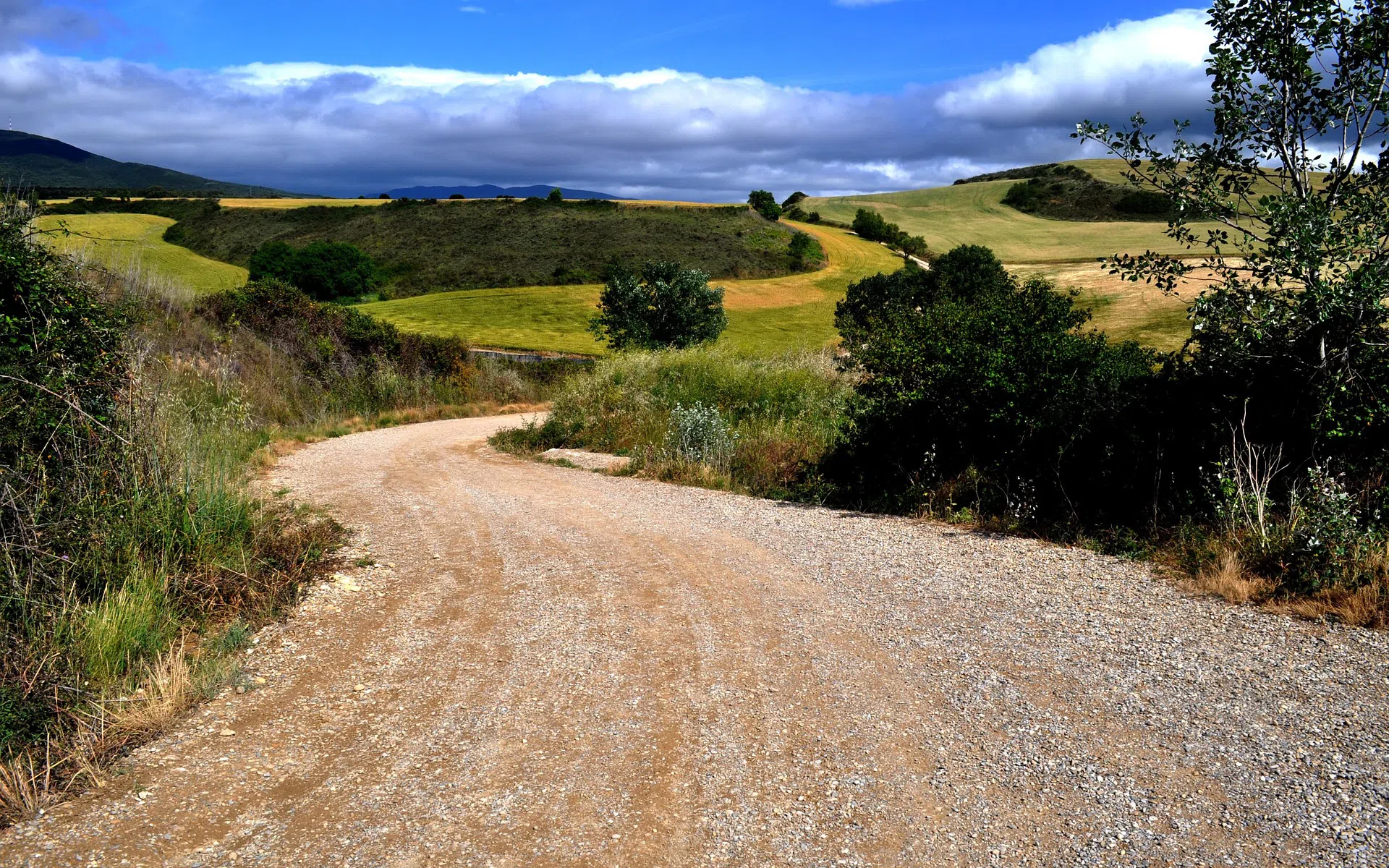
The geography of the English Way is marked by an extraordinary variety of landscapes that accompany the pilgrim from the maritime dimension to the rural heartland of inland Galicia. The route crosses the northern rías, those narrow fjord-like inlets that cut deeply into the Atlantic coast, before entering valleys dotted with hórreos (the typical Galician stone granaries), passing through eucalyptus forests with their intense fragrance and discovering ancient medieval bridges that have withstood the passage of centuries. From the point of view of the walking surface, asphalt predominates, mainly in the form of rural tracks or local roads with very little traffic, although in recent years the route has recovered several dirt sections corresponding to the ancient Camiño Real, the historic track traditionally used by pilgrims bound for Compostela and by goods carriers. A substantial modification of the route was carried out by the Xunta de Galicia in 2017, particularly along the stretch between Betanzos and Hospital de Bruma, with the declared aim of “softening” distances and elevation changes, although this decision sparked controversy among purists of the Way and introduced some short sections along the edge of busy roads that require particular attention from pilgrims. The artistic heritage along the route includes valuable examples of Romanesque architecture, Gothic and Baroque churches, Franciscan convents and the imposing military heritage of Ferrol, one of the most important arsenal cities in 18th-century Spain.
What sets the English Way apart from the other routes to Santiago is its intimate dimension and the more measured pace that allows each stage to be savored in greater depth. The level of difficulty is medium-low, with moderate elevation changes and generally gentle terrain, although some sections feature demanding climbs, especially when crossing the hills that separate the coast from the interior, such as the notable ascent leaving Pontedeume. This route is particularly well suited to those seeking an authentic experience away from the crowds, to pilgrims with limited time who nevertheless wish to obtain the Compostela starting from Ferrol and to those who appreciate the blend of maritime and rural landscapes in a distinctly Galician setting.
The English Way Route
The pilgrimage from the port of Ferrol begins in the heart of this historic seafaring city, where the 18th-century military arsenal tells centuries of Spanish naval history and where medieval pilgrims once set foot after long Atlantic crossings. Leaving behind the sheltered waters of the ría of Ferrol, the route winds through modern neighbourhoods before immersing itself in the Galician countryside, crossing small rural settlements where time seems to have stood still and where granite hórreos dot the lush green fields. The path soon leads to Neda, a charming village set along the banks of the river of the same name, famous for its waterfalls that once powered numerous mills and continues on to Pontedeume, one of the most captivating stages of the entire itinerary. This medieval town preserves the remains of an imposing 14th-century tower belonging to the Andrade family, the powerful feudal lords who dominated this region and boasts a beautiful medieval bridge with fifteen arches spanning the river Eume, a witness to the passage of countless pilgrims over the centuries.
From Pontedeume, the path enters the valley of the river Eume, one of the most evocative areas of Galicia, where lush vegetation forms a natural green cathedral and where Atlantic humidity nourishes forests of oaks, chestnuts and eucalyptus trees. The route reaches Betanzos, an authentic medieval gem that deserves a longer stop to admire its splendid Gothic churches of Santa María de Azogue and San Francisco, the latter home to extraordinary medieval funerary sculptures that represent one of the high points of Galician Gothic art. The cobbled streets of the historic centre, the noble palaces with their stone coats of arms and the timeless atmosphere make Betanzos one of the most pleasant surprises of the English Way. Leaving this architectural jewel behind, the pilgrim faces one of the most demanding stretches of the route, a climb that leads through shady forests and rural paths towards the inland plateau, where the landscape opens up into broad valleys dotted with small villages.
The route passes through Hospital de Bruma, a place whose name evokes the ancient presence of a pilgrims’ hostel and where the mist (bruma in Spanish) frequently envelops these highland landscapes, creating a mystical atmosphere. It is precisely at this point that the alternative itinerary coming from A Coruña joins the route.
The variant from A Coruña
The shorter variant of about 73 kilometres, which starts from the beautiful maritime city overlooking the Atlantic, allows pilgrims to reach Santiago de Compostela in 3 or 4 days of walking. Before leaving A Coruña, pilgrims should explore the historic centre with its narrow medieval streets leading to Praza de María Pita, dominated by the statue of the local heroine who, in 1589, bravely defended the city from the assault of the English corsair Francis Drake. The ascent to Monte de San Pedro offers the best panorama of the city, while a walk along the seafront allows visitors to admire the famous Tower of Hercules, the oldest still-functioning Roman lighthouse in the world and a UNESCO World Heritage Site, as well as the splendid modernist buildings with their characteristic glass galleries that have earned A Coruña the nickname “the glass city”. The traditional route starts behind the Church of Santiago, near Praza de María Pita, crosses Avenida da Mariña and continues through the Cuatro Camiños district along Calle Fernández Latorre towards the area of Eirís. After about seven kilometres, the city is left behind through the open area of O Burgo, an ancient fishing village with an authentic atmosphere, to enter the municipalities of Culleredo and Cambre, where the urban landscape gradually gives way to the Galician countryside. The route reaches Santiago de Sigrás after fourteen kilometres, continuing towards the small town of Carral, renowned for its traditional bread that pilgrims can purchase from local bakeries. From here the path crosses San Xián de Sergude in the municipality of Abegondo, passing through rolling countryside and eucalyptus forests, through As Travesas and finally, just a short distance from Bruma, where this variant joins the route coming from Ferrol.
From Hospital de Bruma, the route continues through a succession of small settlements and wooded stretches, reaching Sigueiro, the gateway to the comarca of Santiago, where the closeness of the final destination begins to be felt and the pilgrim’s excitement grows with every step. The final kilometres cross the outskirts of the city of Compostela, with its industrial areas that gradually give way to the historic centre, until the climactic moment of entering Praza do Obradoiro, where the Baroque façade of the Cathedral of Santiago rises majestically before the emotional eyes of the pilgrim who has completed the journey. Embracing the statue of the Apostle James inside the basilica and attending the pilgrims’ mass, with the famous botafumeiro spreading incense through the nave, represent the spiritual culmination of an experience that, despite its relative brevity, contains the full essence of the Jacobean pilgrimage.
How to get to Ferrol
By Plane: The closest airport to Ferrol is Santiago de Compostela–Rosalía de Castro Airport (SCQ), located about 90 kilometers away and connected to major Spanish and European cities through direct flights operated by both traditional and low-cost airlines. From the airport, Ferrol can be reached by combining a bus to Santiago de Compostela and then a coach or train service to Ferrol. An alternative option is A Coruña Airport (LCG), smaller but closer (about 60 kilometers), with domestic connections and some international flights. For travelers arriving from more distant international destinations, Madrid Airport, located about 500 kilometers away, offers a wider range of intercontinental flights, although it requires a longer onward transfer by bus or train.
By Train: Ferrol’s railway station is well connected with the main Galician cities and the rest of Spain through Renfe services. From Santiago de Compostela, frequent regional trains reach Ferrol in about one and a half hours, offering a convenient option for those landing at the Santiago airport. From A Coruña, the rail connection is even faster, with a journey time of about 45 minutes. Travelers coming from Madrid can take long-distance trains to A Coruña and then change to a regional train to Ferrol, with a total travel time of approximately 6–7 hours.
By Bus: The coach companies Arriva and Monbus operate regular services between Ferrol and the main Galician cities. From Santiago de Compostela, numerous daily departures take about 1 hour and 30 minutes. From A Coruña, services are even more frequent, with buses taking around one hour. Ferrol’s bus station is centrally located and well connected to the official starting point of the English Way. For those arriving at Santiago airport, it is possible to take a bus to Santiago’s bus or train station and then continue onward to Ferrol.
How to get to A Coruña
By Plane: A Coruña has its own airport, A Coruña–Alvedro Airport (LCG), located just 8 kilometers from the city center and reachable in about 15 minutes by public bus or taxi. The airport mainly offers direct flights to and from major Spanish cities such as Madrid, Barcelona, Seville and Bilbao, as well as some seasonal connections with European destinations. For travelers who need a wider range of international flights, Santiago de Compostela Airport (SCQ), located about 70 kilometers away, is the main alternative, offering connections to numerous European destinations and some intercontinental routes. From Santiago airport, A Coruña can be reached by direct bus, with regular departures and a travel time of about one hour.
By Train: A Coruña’s recently renovated railway station is one of the main rail hubs in Galicia, with excellent connections to major Spanish cities through Renfe services. From Madrid, Alvia high-speed trains depart daily and reach A Coruña in about 5 hours and 30 minutes, offering a comfortable and scenic option that crosses northwestern Spain. From Santiago de Compostela, regional trains are extremely frequent, with departures approximately every hour and a journey time of just 30–40 minutes, making the connection between the international airport and the starting point of the route particularly easy. Rail connections are also available with Pontevedra, Vigo and other Galician cities, as well as with León and Oviedo in neighboring regions.
By Bus: The bus network serving A Coruña is particularly extensive and efficient, with Monbus providing comprehensive connections throughout Galicia. From Santiago Airport, direct buses operated by Empresa Freire reach A Coruña in about 50 minutes to 1 hour, stopping at the city’s bus station, which is perfectly connected to the historic center. From Santiago de Compostela city, services run very frequently throughout the day, with a travel time of about 45 minutes. A Coruña’s bus station is strategically located near the railway station, making it easy to reach the official starting point of the English Way at the Tower of Hercules or the historic center.
When to walk the English Way
Choosing the best time to undertake the English Way depends on personal preferences and time availability, bearing in mind that Galicia is characterized by a humid Atlantic climate with rainfall spread throughout the year. Spring (April–June) is one of the most enchanting periods, when the Galician countryside is covered in intense shades of green, wildflowers line the paths and mild temperatures (15–20°C) make walking particularly pleasant, although spring rains may require suitable equipment. Summer (July–August) offers the warmest temperatures (20–25°C) and the greatest weather stability, but it also coincides with peak tourist numbers and the possibility of muggy days in inland sections away from the sea breeze, as well as generally higher accommodation prices.
Autumn (September–October) is considered by many experienced pilgrims to be the ideal season, when the climate remains mild, autumn light gives the landscapes particularly photogenic golden and reddish hues and the number of walkers decreases significantly compared to summer, restoring that sense of contemplative solitude that represents one of the route’s most authentic values. Winter (November–March) is the most challenging season, with cool temperatures (8–12°C), frequent rainfall and shorter days that limit available walking hours, but it offers the most motivated pilgrim an even more intimate and authentic experience.
The best period is generally between late April and June and again between September and mid-October, when the ideal balance is achieved between favorable weather, lush landscapes and a moderate flow of pilgrims. It is important to consider that proximity to the Atlantic Ocean makes the climate of the English Way particularly variable and unpredictable, with the possibility of rain even during statistically drier months, making proper waterproof clothing essential at all times, along with the mental flexibility needed to accept weather surprises as an integral part of the Galician experience.
Practical advice for the pilgrim
Accommodation along the English Way includes public and private hostels, guesthouses, rural houses and hotels for every budget, with generally good availability in the main towns such as Pontedeume, Betanzos and larger villages. However, in small rural hamlets options may be limited, making advance booking advisable, especially during peak months. Pilgrim hostels require presentation of the pilgrim credential and offer dormitory-style accommodation at affordable prices (€8–15), while private establishments provide greater comfort and privacy at variable rates. The pilgrim credential (credencial) is essential to access albergues and to obtain the Compostela at the end of the route. It can be requested from Camino de Santiago associations, in the parishes of Ferrol or A Coruña, or at some accommodations along the way. It should be remembered that, in order to receive the Compostela certificate, it is necessary to have walked at least the last 100 kilometers on foot (a requirement met only by those starting from Ferrol) and to have the Credential stamped at least twice a day.
The signposting of the English Way is generally good, with the classic yellow arrows guiding pilgrims along the entire route and the scallop shells of Saint James confirming that one is on the correct path. Nevertheless, in some rural stretches or when passing through built-up areas, greater attention may be required, as well as consultation of a printed guide or a GPS application dedicated to the Jacobean routes. It is essential to carry appropriate equipment, including well-broken-in trekking shoes, an ergonomic backpack that is not too heavy (maximum 10% of body weight), layered clothing to adapt to changing weather conditions, a high-quality waterproof jacket and trousers, sunscreen and a hat to protect against the summer sun and a small supply of medication for blisters and minor ailments. The pilgrim’s first-aid kit should include blister plasters, disinfectant, anti-inflammatory medication and any personal medicines that may be required.
From the perspective of daily organization, it is advisable to start walking early in the morning to avoid the heat during the central hours of summer and to secure a place in public hostels, which operate on a “first come, first served” basis. Maintaining a steady pace without rushing, listening to one’s body, taking regular breaks to hydrate and eat and always respecting the natural environment and the local communities along the way are all essential. The pilgrimage is also an opportunity to savor the extraordinary Galician gastronomy, from the fresh seafood of the rías to Galician-style octopus, from traditional empanadas to local cheeses, accompanied by excellent Albariño white wines or Ribeiro reds, turning every stop into a moment of cultural discovery as well as physical refreshment.
Why choose the English Way
The English Way represents an ideal choice for those seeking an authentic and intimate experience of the Jacobean pilgrimage, far from the crowds that especially characterize the famous French Way during the summer months. The relatively lower number of pilgrims allows for a more contemplative rhythm, deeper conversations with fellow travelers met along the route and a more direct connection with local communities, which keep alive the tradition of welcoming pilgrims without the standardization that sometimes affects the more heavily traveled routes. The maritime dimension that characterizes the beginning of the route makes it unique among the Jacobean paths, offering breathtaking Atlantic views and the distinctive energy of the Galician rías.
The landscape richness of the English Way concentrates, in just a few days of walking, an extraordinary variety of environments: from wind-swept Atlantic coasts to lush river valleys, from fragrant eucalyptus forests to pastures dotted with traditional stone buildings and finally to perfectly preserved medieval towns such as Betanzos and Pontedeume, which represent true jewels of Galician historic architecture. The cultural heritage along the route includes Romanesque, Gothic and Baroque landmarks of great value, creating a continuous dialogue between different periods of European history.
This route is particularly suited to those with limited time who do not wish to give up the full pilgrimage experience with the attainment of the Compostela (by starting from Ferrol), to walkers looking for a route of moderate difficulty without the extreme challenges of other mountainous itineraries and to those who appreciate a more intimate and spiritual dimension compared to a purely tourist-oriented experience. Galician cuisine and wines, the genuine hospitality of the local people and that distinctive Atlantic light that envelops landscapes and monuments complete an experience which, despite its relative brevity, contains all the essential elements of a pilgrimage: physical effort, cultural discovery, human encounter and, for those who seek it, an inner journey toward a destination that is as spiritual as it is geographical.
Plan your route with the The Camino Ingles App
Download or print the PDF guide of The Camino Ingles
The Forwalk paper guide is an A5 format mini-book with all the information on your chosen paths, the detailed maps, the list of hotels and much more. It is very easy to consult and to carry along during your trip. This guide is completely personalized to your needs and made available to you digitally (Acrobat Reader PDF file), to be accessed through smartphones and tablets or printed by you. You can also order it already printed in color on glossy paper, and delivered to you as a finely bound book.
Download the gpx routes map of The Camino Ingles
GPX tracks are maps that you can download on GPS device to take with you on your walk. Our GPX tracks include routes with details of places such as shops, restaurants, lodgings, drinking fountains and springs.
- Download From Ferrol to Santiago
- Download Ferrol to Finisterre and Muxia
- Download From Ferrol to Santiago in 9 days
- Download From A Coruña to Santiago
Our GPX tracks are tested on the following devices : Garmin ETREX 22x, Garmin eTrex Touch 35, Garmin Oregon 700, Garmin GPS MAP 66